
Take to the water
Loch Lomond & the Trossachs
Jewelled by emerald islands, fringed by beautiful wooded shores and surrounded by grand hills and mountains, Loch Lomond – where the Scottish Highlands “begin” – often feels much further from civilisation than it actually is. Balloch, on the southern shores of the loch, is just a 50-minute train ride from Glasgow Queen Street. From there, a network of waterbuses links a constellation of points across Loch Lomond and its neighbour in the Trossachs, Loch Katrine, and they make getting around a joyful novelty.
Lovely shoreside settlements such as Luss, Balmaha, Tarbet and Inveruglas all make a pleasant bases. A three-day rover ticket (£30 adult, £20 child) allows unlimited waterbus travel. Joining these with the area’s network of walking and cycling trails opens a whole world of possibilities, much of which is off-limits to the car-bound.
Catch a waterbus to Rowardennan, walk the seven-mile section of the West Highland Way along the east shore of Loch Lomond to Balmaha, then hop on another boat to the beautiful island of Inchailloch on the way back to your starting point; or take your bike and hop over both Loch Lomond and Loch Katrine to cycle back along the 18-mile length of gorgeous Loch Katrine.
• Waterbus information
Dreams of steam
North York Moors Railway
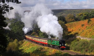
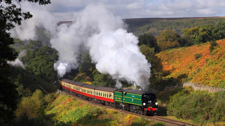
The North York Moors Railway is a remarkably well preserved piece of English history. Connecting Whitby, on the coast, with inland Pickering, it takes hundreds of thousands of visitors a year on a bucolic route across the national park, using a mix of historic steam and diesel locomotives, stopping at points along the way.
With the 24-mile journey between the two terminal towns taking up to two hours, the ride itself, through the sinuous folds of Newton Dale, is something to be savoured. For those who want to make a day of it, a plush Pullman dining train offers lunch, dinner or afternoon tea from £55pp (and yes, there’s also a themed murder mystery train), though non-dining services offer better access for walkers. Jump-off stations include Goathland (try the exquisite circuit connecting the Mallyan Spout and Thomason Foss waterfalls) or Levisham (walk to the punchbowl-shaped Hole of Horcum across Levisham Moor). The best month for walking is August, when blooming heather turns the moorland a riot of purple.
The railway’s very existence is a testament to community pride, perseverance and nostalgia; after the line became a victim of Beeching’s axe in 1965, a small group of locals founded a charity to run a few trains along it, an operation which grew over the decades to become one of the busiest heritage railways in the world. This is a railway run with love.
• North York Moors Railway
Ride the Poppit Rocket
Pembrokeshire
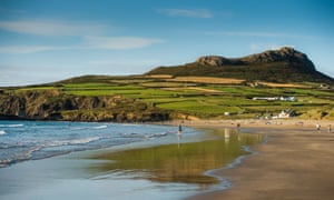
The Atlantic-battered shores of Britain’s only coastal national park are well-served by an integrated network of buses. The coastal lines run from tourist hubs such as the city of St Davids, and these in turn are served by buses from the railway station at Haverfordwest.

The small hopper buses often run right to the edge of great beaches and cliffs, and on country lanes passengers can just stick out a thumb to stop the bus. Using the buses helps ease traffic congestion, which at busy times of year can make driving on the narrow roads fraught and frustrating. But they are also a great way to access the start or end of sections of the Pembrokeshire Coastal Path, a national trail that hugs the coast round the entire park, and avoid walking back to the car.
There isn’t a dull stretch, but highlights include the leg from St Non’s to Whitesands, adding in a loop of St David’s Head via the mini-mountain of Carn Llidi (served by the 403 Celtic Coaster from St Davids).
Charming fishing villages hunker in coves, eggshell-coloured beaches slope into turquoise water, and iron age and neolithic relics create a powerful atmosphere of antiquity.
A challenging stretch is the 18-mile section from Newport to Cardigan (served by the 405 Poppit Rocket), which teeters along the top of cliffs twisted in extraordinary shapes.
Walk this way
South Downs

The South Downs national park is probably the easiest in the UK to explore by public transport. Lying between London and the south coast, and home to 120,000 people (the UK’s most populated park), this is no remote wilderness; its rolling chalk hills are dissected by several roads and train lines.
Trains from Waterloo and Victoria reach Lewes or Winchester in less than 90 minutes, from where smaller branch lines and bus networks open up a chocolate box of possibilities for linear walks or cycle rides. The Discovery Ticket gives unlimited bus travel for £17.50 a day for a family of five (individual tickets £9 adult, £7.20 child).
The public transport possibilities make it possible to walk the entire length of the 100-mile South Downs Way at convenient intervals using trains and buses alone. The National Park authority produces a fantastic guide to doing just this – as a walking project to be completed over a fine summer, or by picking and choosing routes: Amberley to Eastbourne is a good bet, with a stretch that includes the Seven Sisters white cliffs.
• Walk on the South Downs Way
Climb Snowdon the smart way
Snowdonia
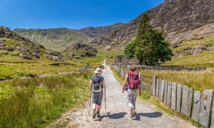
Wales’s highest mountain is a starfish-shaped massif of almost-Alpine grandeur, haunted by legend and bygone industry, and populated with falcons, goats and rare beetles. But with almost half a million visitors a year, it is among the busiest mountains in the world, up there with Mount Fuji.
Its mountain railway partly accounts for this, but some of its walking paths are being loved to death, and on a sunny summer day, popular routes such as the Llanberis Path can become jostling nose-to-tail processions. Not surprisingly, finding a parking space at a place like Pen y Pass, starting point for other popular walking routes, is an unseemly early morning scrabble, and the parking itself isn’t cheap.
Enter the Snowdon Sherpa, an integrated network of buses connected to tourist hubs like Llandudno and Betws-y-Coed. Just £5 a day buys access to the whole network, which stops at the foot of all six of the main walking routes to the summit. It cuts out the steep parking charges, but perhaps the biggest draw is being able to ascend one way and descend another, seeing more of this complex, multifaceted mountain in one go. Try linking the Snowdon Ranger Path with the Watkin Path for a strenuous but deeply rewarding day on less-trodden routes.
The Guardian



Leave a comment